Things You See, Going Back and Forth to Phoenix
I like driving, especially when there's things of interest to see beside the roadside. I've thought from time to time that an interesting living would be writing about the stuff you see along the highway as you drive along. Lots of opportunity for brand extention... call it "What Is That--LA/San Francisco/Highway 10/Phoenix/San Diego" etc. A photo book where you explain the unusual items of interest along the way. For instance, if you ever take off from LAX and look down just as you approach the shore you see what looks like a subdivision, complete with street signs, that has foundations but no homes. Turns out this was a neighborhood that existed from about 1928 to 1965, when the neighborhood was purchased to clear the way for an expansion of the airport. Read about it here (courtesy of Pete of the Street, a guy clearly after my own heart).Anyway, as my readers (and listeners of Godscrum) know, I've been doing a lot of driving back and forth to Phoenix to be with my wife and daughter, in Phoenix caring for my mom. These drives take me through the Mojave and Sonoran deserts that make up a significant portion of the land mass of Southern California. The more direct eastern route to Phoenix is along Interstate 10, and the lengthier southern route is via Interstate 8.
Here's some interesting things I've seen on the eastern route:
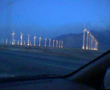 The San Gorgonio Pass wind farm
A collection of wind turbines both old and new (dating back to the 1980s), and the largest wind development in the United States at over 600 megawatts in capacity. That's just a small portion of it to the left, shot from my car on my cheap camera phone. When my office hosted the annual company offsite summit last year I organized a tour of the development.
The Salton Sea
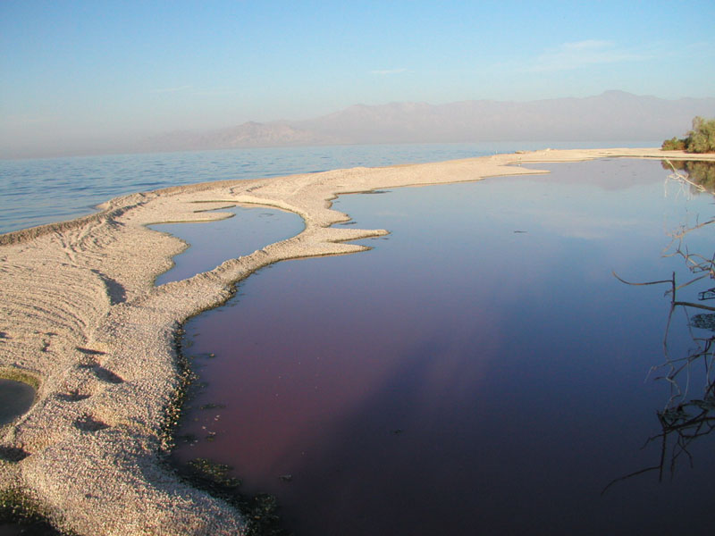 The Salton Sea can be seen in fleeting glimpses on a clear day from the 10 as you ascend up from the Coachella Valley and leave Palm Springs behind. I'll tell the story of this lake, but before I do please comment or send an email if you already know the history of the Salton Sea. So few I meet do. Anyway, the Salton Sea is a depression that once held an ancient lake but had been mostly dry for a few hundred years until 1905 when an attempt to build an agricultural irrigation channel into the Colorado river failed and virtually the entire flow of the river poured into the old basin for more than a year. Since then, the lake has been fed by agricultural runoff from the surrounding Imperial Valley. The salinity of the lake makes from good waterskiing, but I won't go in that water again. It's pretty vile.
Chiriaco Summit and the Patton Museum
The 10 peaks out at Chiriaco Summit, home of the most expensive gasoline in the desert and the General George S. Patton Memorial Museum. I've never taken the time to go into the museum. You can see the tanks set up outside, though.
Desert Center
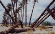 Not much to see in Desert Center, and not too much to tell about it either other than the fact that I decided on a late night drive one time to forgo fueling up at Chiriaco Summit only to find out that cheaper Desert Center was out of gas and I had to drive the 25 miles back to the Summit and pay through the nose. Oh, there are the dying date palm groves to see, though. Turns out the eccentric old guy that had them trucked in died, and they haven't been properly irrigated.
Ironwood State Prison
About a half hour east of Desert Center you can see the minimum-to-medium security Ironwood State Prison along with signs warning you not to pick up hitchhikers. Like I would have anyway. By the way, the facility has a design capacity of 2,200 but houses over 4,000 inmates. Sounds cozy.
Blythe
Blythe sucks. That's the general consensus within my family. Blythe sits off the 10 just this side of the CA-AZ border separated from the Colorado River by some farms and marshes. I will give it this, though: it has a drive-through Starbucks.
The Colorado River
As the Colorado River goes, this isn't a very impressive crossing but it's nice after a few hours of desert driving to see the deep blue water and the green grass. Interesting aside: a flight from Phoenix to Orange County on Southwest Airlines follows the 10 right over this crossing, which you can see from the left side of the plane.
Palo Verde Nuclear Plant
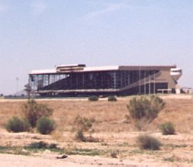
Phoenix Trotting Park
This track was built in the 60's for harness racing, but it went belly-up after just a couple of years. The operators of the local greyhound racing track bought it to keep it from competing with them, and so it has languished for thirty years, just baking in the sun off of the 10. Eventually they'll tear it down for a mall or some homes. The metro area is spreading like a prairie fire and it can't be long before they finally bulldoze the thing.
Today I took the longer but more attractive southern route on Interstate 8, which goes through Yuma and San Diego, then up the coast on Interstate 5. There's not as many oddities that I've seen, but the scenery is a lot lovelier the whole way through. Nice desert vistas all the way to Yuma, home of a lot of agriculture and a big Marine base (I've seen Harrier jets about from time to time). But just inside the California border are the Imperial Dunes, a five mile wide chunk of dunes stretching 40 miles from the Mexican border to the Salton Sea.
 Some noteworthy items about the dunes: two thirds of them are open to offroaders, and nature preservationists complain that the offroaders acts like the remaining third is open to them as well. There used to be a couple of plank roads built across the dunes, and some fragments still remain. Finally, the scenes from Return of the Jedi featuring Jabba's floating yacht were filmed in the dunes. Check out this phenomenal set they built:
 That's the back side.. the front side looked like this:
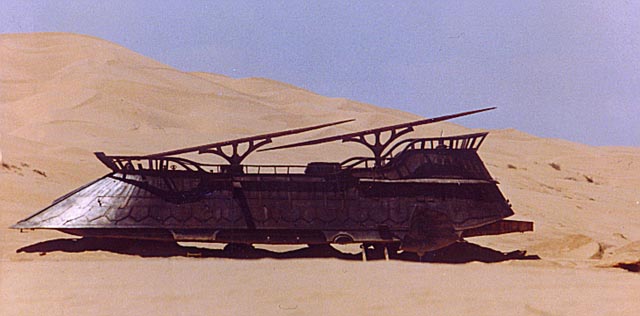 Pretty impressive. A few weeks after these shots were taken, the whole thing was disassembled and hauled off.
West of the dunes the 8 rises up to 4,000 feet where, at the summit, California's newest wind farm was constructed:
 These turbines are significantly larger than the largest turbines in Gorgonio due to height restrictions in the Palm Springs area. And they dominate the skyline for miles around, much to the aggravation of some locals.
As you close in on San Diego from the east, you pass a few ubiquitous Indian casinos and bedroom communities before the 8 meets the 5 near the coastline. From there, it's 100 miles of the prettiest, most (relatively) pristine coastline that Southern California offers. This is largely due to the expansive Camp Pendleton Marine Base, which occupies miles of shoreline and extends inland farther than the eye can see. I've seen Marines practicing assaulting the shoreline, complete with tanks and helicopters with large warships offshore.
Thanks for bearing with me through a post that had little to do with anything but that was fun to put together.
posted by Zeke @ 7:49 PM
![]()


1 Comments:
I love photo essays.
(p.s. I'm back!)
Post a Comment
<< Home